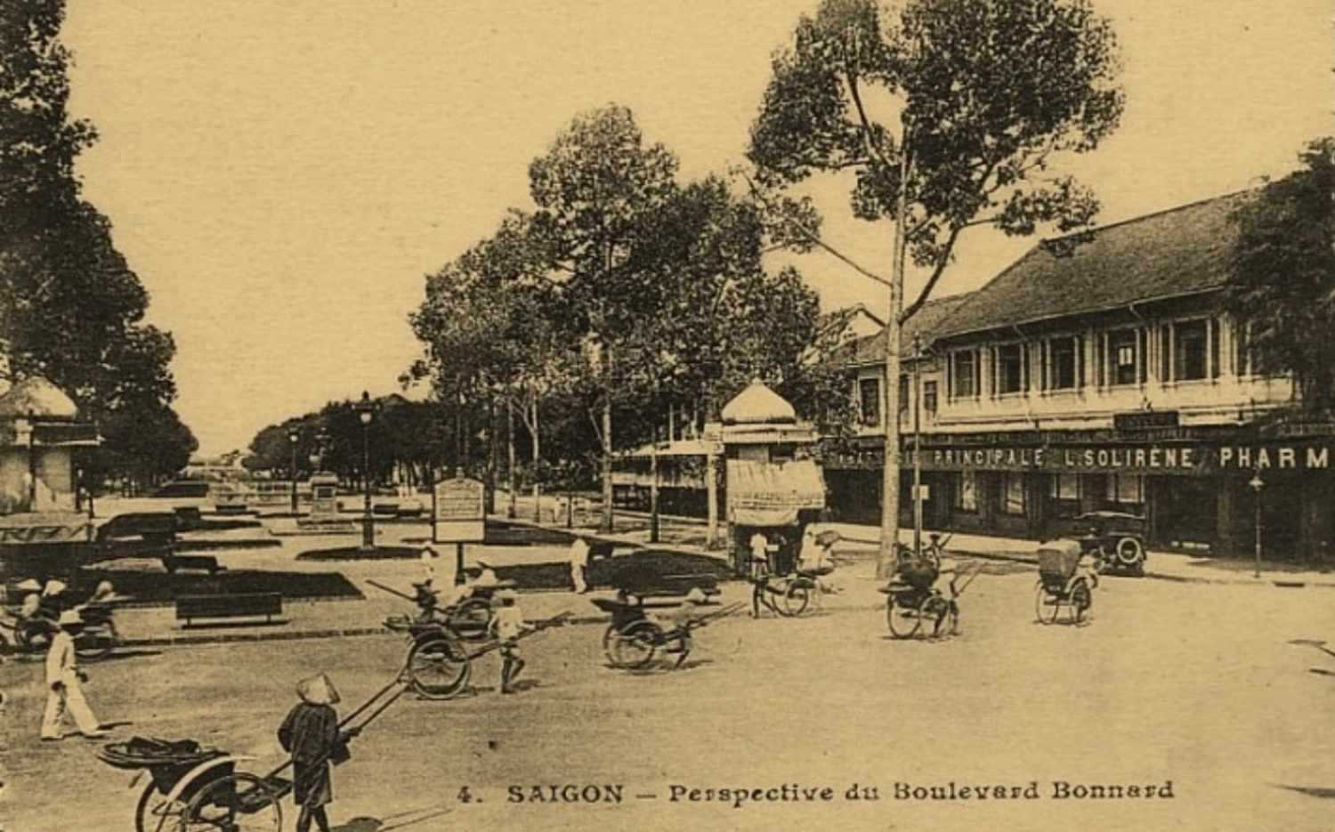
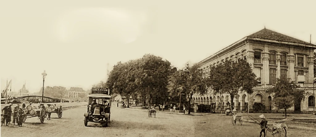
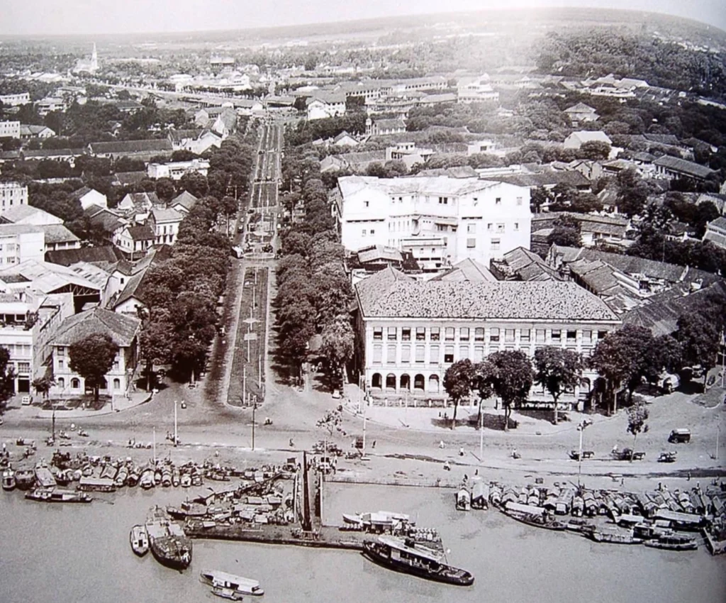
The scene of Bach Dang wharf bustling with boats and rickshaws on Bonard Street (Le Loi) was captured through the lens of a photographer in the early 20th century.
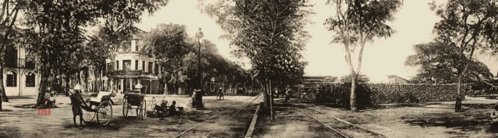
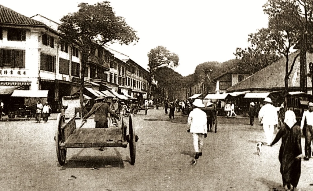
Scene of people traveling on Ton Duc Thang Street in the early 20th century. In 1865, the French named this street Boulevard de la Citadelle. At that time, the main means of transportation was handcarts (also known as rickshaws), with about 400 of them in Saigon. The photo was introduced in the book
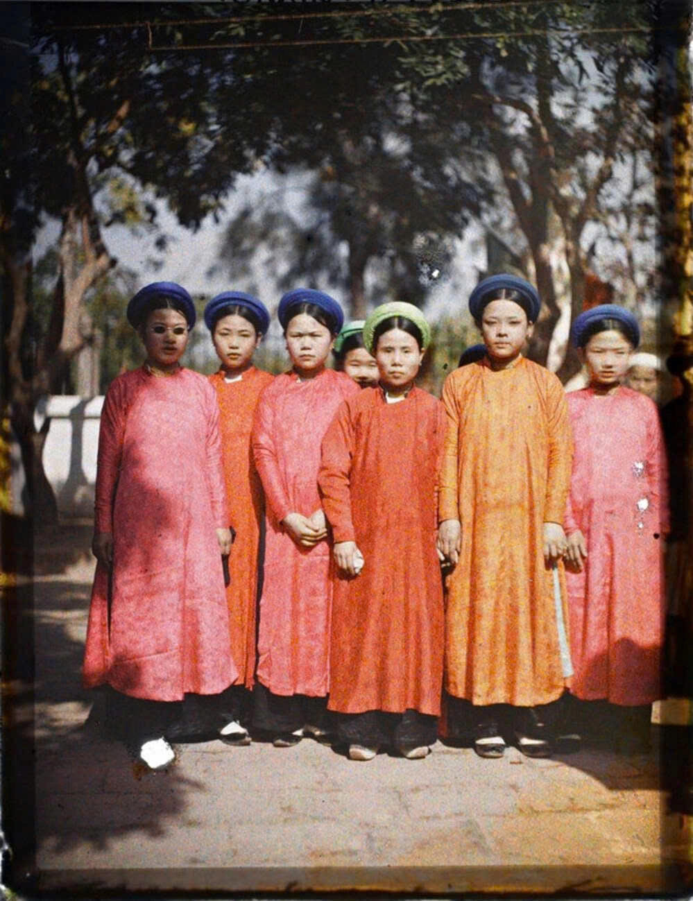
Saigon – Ho Chi Minh City Heritage , edited by author Nguyen Hanh, recently released by Ho Chi Minh City General Publishing House.
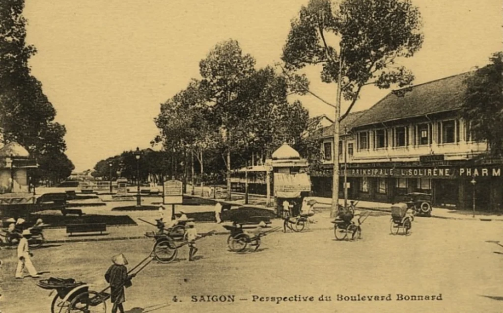
Le Loi Street is one of the oldest and most typical streets in the city. Initially, it was just a canal about 0.8 km long, dug in 1861-1862. The road along the canal was named Street No. 13, and in 1865 it was renamed Bonard Street.
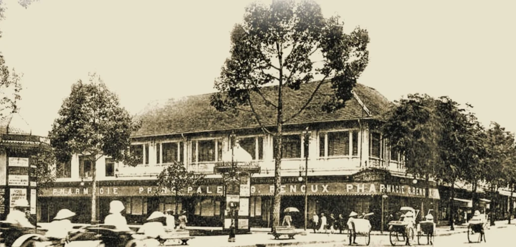
Le Loi is also the busiest street in old Saigon, home to many hotels and shops of major brands.
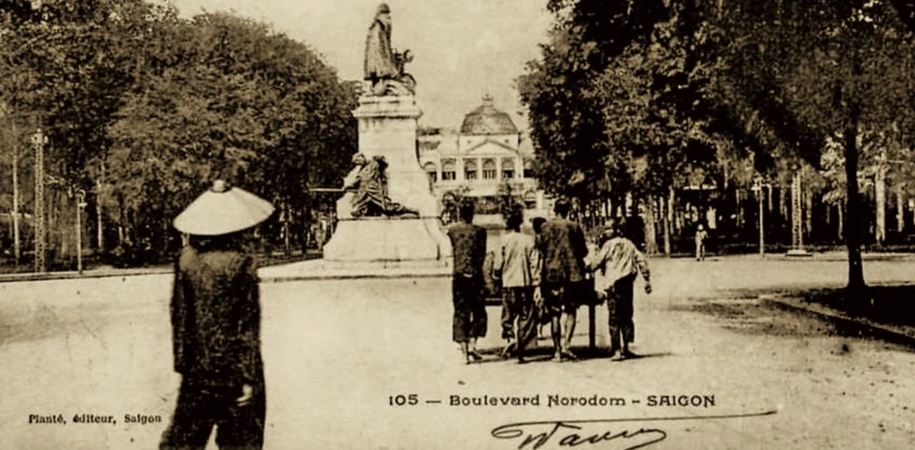
Le Duan Street was formed in the 1870s, originally named Boulevard Norodom because it leads to Dinh Norodom (Independence Palace). Around this nearly 2 km street are many of the oldest buildings in the city, such as Notre Dame Cathedral, Onzième Barracks (Ong Dem Barracks), and the Zoo and Botanical Gardens.
Ho Tung Mau Street was originally called Adran Street, then renamed Georges Guynemer Street.
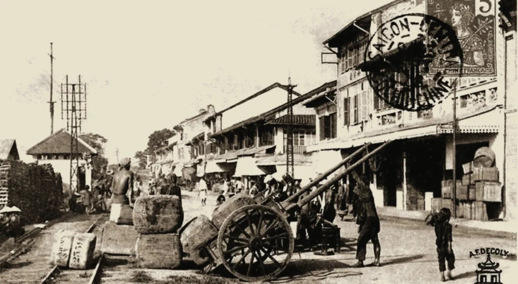
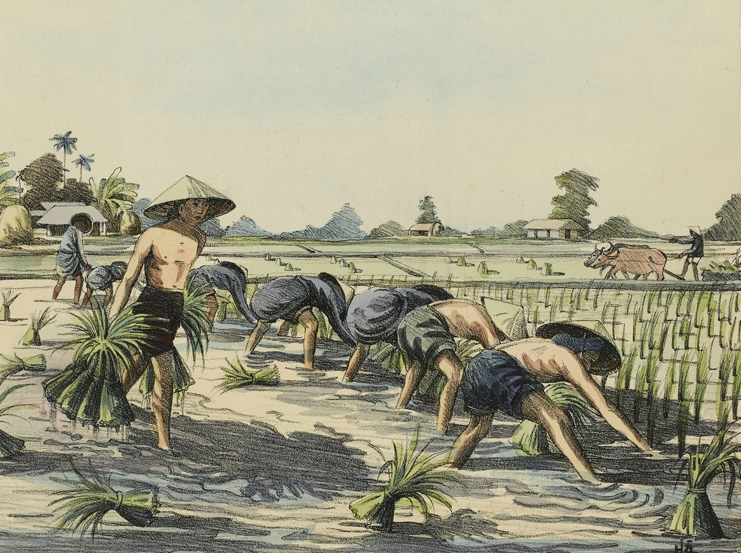
Workers in Cho Lon in the early 20th century. Until 1865, Saigon and Cho Lon were still two separate cities, separated by a number of villages and swampy fields. The French built a road through the fields, the road from Cho Lon was named Rue des Marins (Watermen’s Road).
In 1916, the two cities were connected by Galliéni Avenue. Initially, the road was paved with laterite, then paved with asphalt, with a row of electric lights in the middle and tram tracks on both sides.
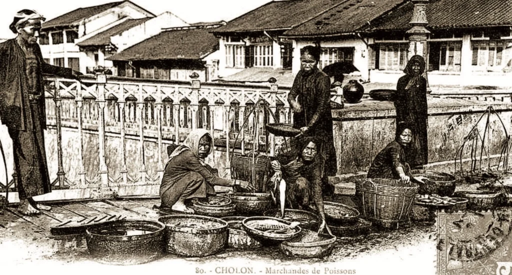
People trade on Cha Va – a bridge with a history of over 100 years, connecting District 5 with District 8, spanning the Tau Hu canal. The area near the bridge is an Indian market street specializing in selling fabrics. According to author Nguyen Hanh, the French originally named the bridge Malabar – a coastal area in the West of India where many people migrated to Saigon.
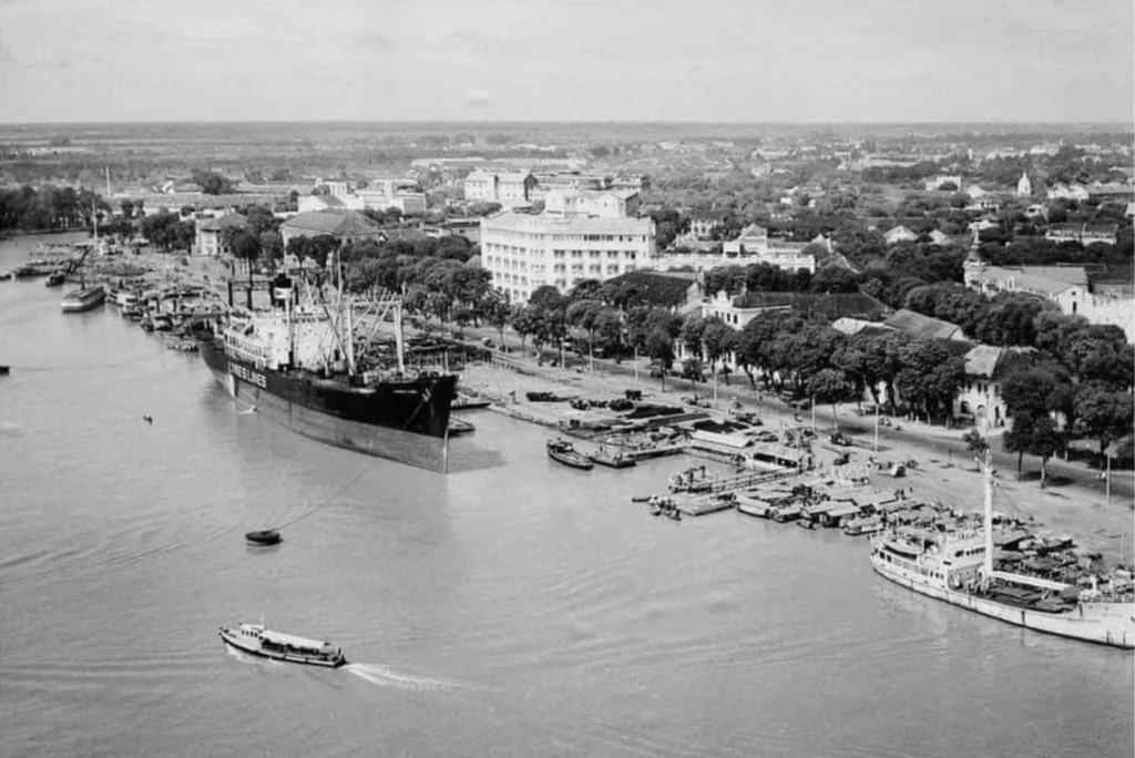
Bach Dang Wharf on the Saigon River. The area is located on Ton Duc Thang Street facing the river, stretching from Khanh Hoi Bridge to Ba Son Factory. According to researcher Vuong Hong Sen , Bach Dang is associated with the history of three victories over the Yuan-Mongol army, so the location was named to commemorate the heroic feat of the Dai Viet army and people.
The scene of the wharf and the boat on the Saigon River. In the middle of the wharf is the Tran Hung Dao monument, located in the semicircular Me Linh Square, where six streets intersect: Ton Duc Thang, Thi Sach, Hai Ba Trung, Phan Van Dat, Ho Huan Nghiep and Ngo Duc Ke. During the French colonial period, this square was called Rigault de Genouilly – the name of a French naval admiral who was once the Governor of Cochinchina.
Photo: Provided by Publishing House